earthquakes专题
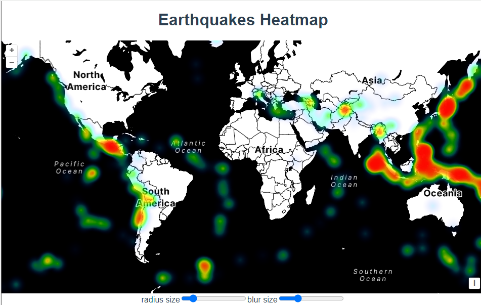
三十七、openlayers官网示例Earthquakes Heatmap解析——在地图上加载热力图
官网demo地址: Earthquakes Heatmap 这篇主要介绍了热力图HeatmapLayer HeatmapLayer 是一个用于在地图上显示热力图的图层类型,通常用于表示地理数据中的密度或强度。例如,它可以用来显示地震、人口密度或其他空间数据的热点区域。在这个示例中,HeatmapLayer 被用来显示从 KML 文件中提取的地震数据。 const vecto
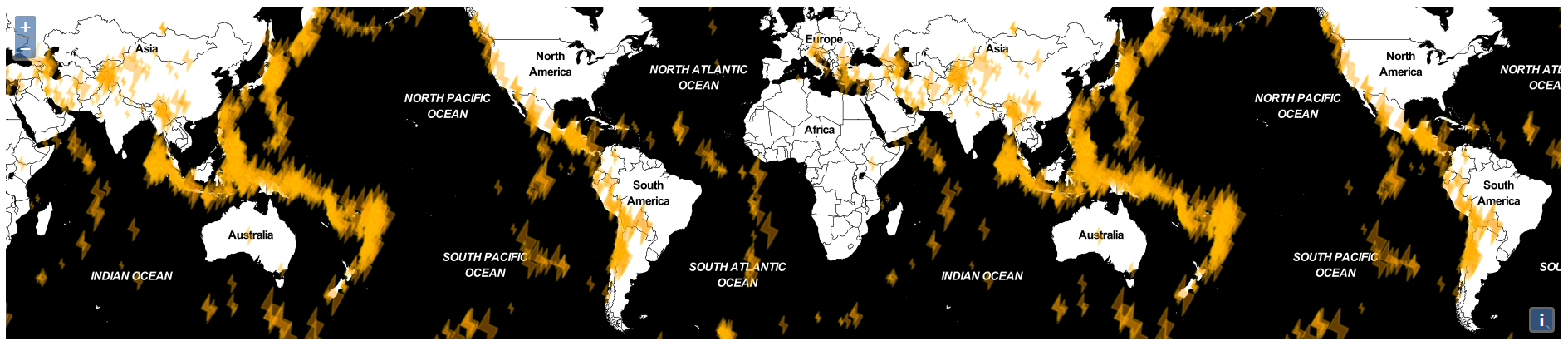
Earthquakes with custom symbols——自定义地震样式
This example parses a KML file and renders the features as a vector layer. The layer is given a style that renders earthquake locations with a custom lightning symbol and a size relative to their